


FARMERSBURG Voting District, Clayton County, Iowa
About
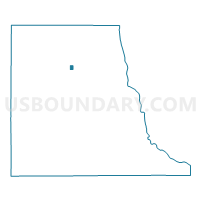
Outline

Summary
| Unique Area Identifier | 581826 |
| Name | FARMERSBURG Voting District |
| County | Clayton County |
| State | Iowa |
| Area (square miles) | 0.40 |
| Land Area (square miles) | 0.40 |
| Water Area (square miles) | 0.00 |
| % of Land Area | 100.00 |
| % of Water Area | 0.00 |
| Latitude of the Internal Point | 42.95886660 |
| Longtitude of the Internal Point | -91.36706940 |
Maps


Graphs
Select a template below for downloading or customizing gragh for FARMERSBURG Voting District, Clayton County, Iowa


Neighbors
Neighoring Voting District (by Name) Neighboring Voting District on the Map
- FARMERSBURG TWP W/O FARMERSBURG Voting District, Clayton County, IA
- WAGNER TWP W/O FARMERSBURG Voting District, Clayton County, IA